
Building polygons
Roof footprints for every property in Great Britain
Every building outline, from the house to its garages, sheds and extensions, traced from aerial photography and lidar, cut to the land-registry boundary and linked by UPRN.
No card required
Woodstock, Cowfold
UPRN 100061824069
| Roof details | Main building | Outbuildings (2) |
|---|---|---|
| Roof area | 244.4 m² | 41.4 m² |
| Height | 3.4 m | 2.4 m avg |
Get the data you need, how you need it. Explore the full report →
What you get
See every building on the plot
Know every structure on a property, not just the house, with a measured outline for each one.
Query the building footprints of any address through our API, or request the full Great Britain roof dataset as a GeoParquet file on the British National Grid.
Every Building on the Plot
The house and its garages, sheds, garden rooms and extensions, each traced as its own roof outline from 25 cm aerial photography, so the outbuildings that change a sum insured are no longer invisible.
Cut to the Property Line
Every roof is cropped to its HM Land Registry INSPIRE parcel and linked to the addresses on it. Terraces and semis are split along party walls, so neighbours never share a roof.
Measured and Scored
Area, lidar height and volume for each building, plus a confidence score and a high, medium or low confidence label on every roof, so you can set your own quality threshold.
Real output
From terraced houses to industrial estates
Unedited roof outlines in amber over drone photography, across residential, town-centre and industrial areas.
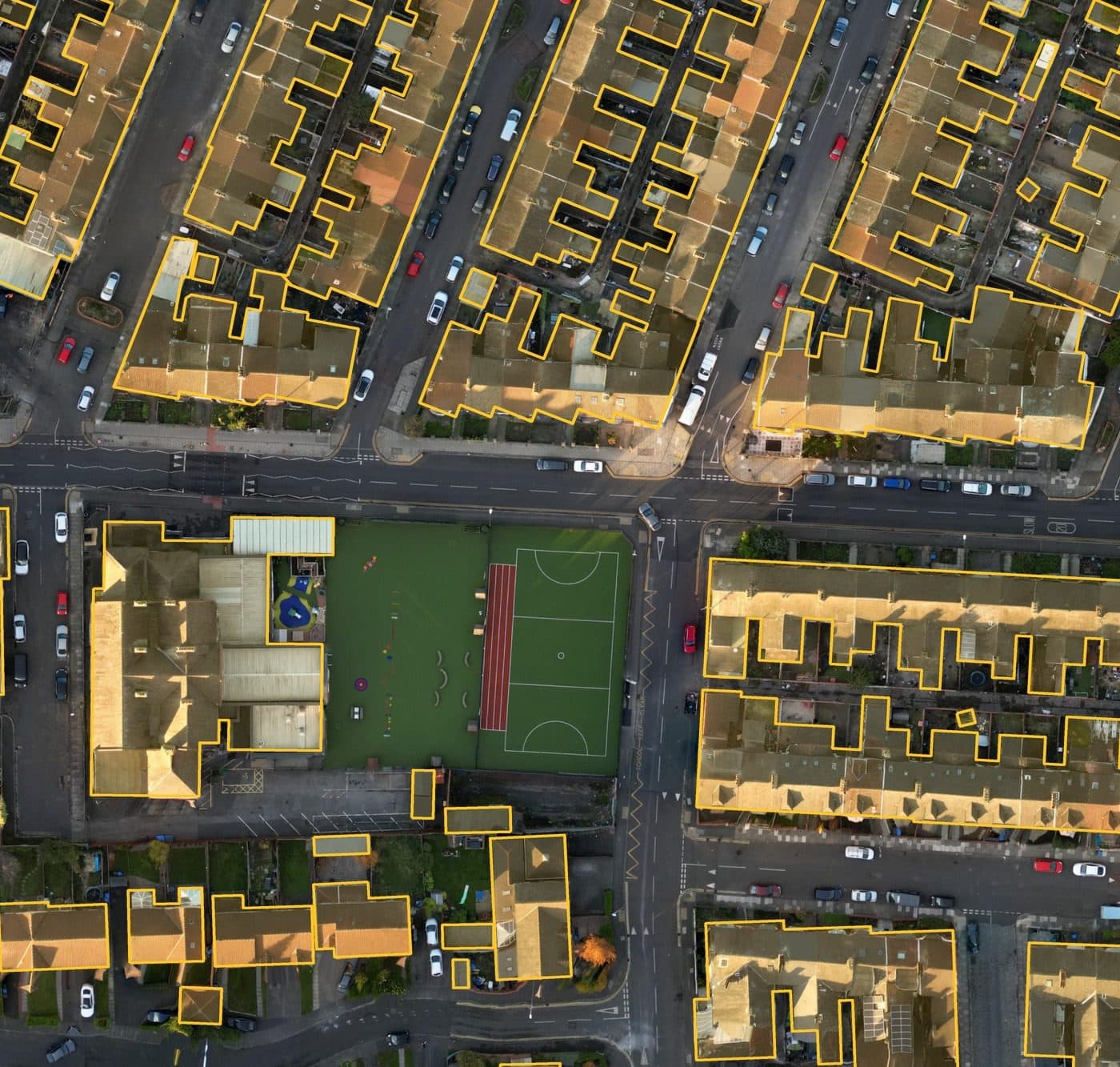
Terraced houses. Long rows of Victorian houses, with rear extensions and shared rooflines.
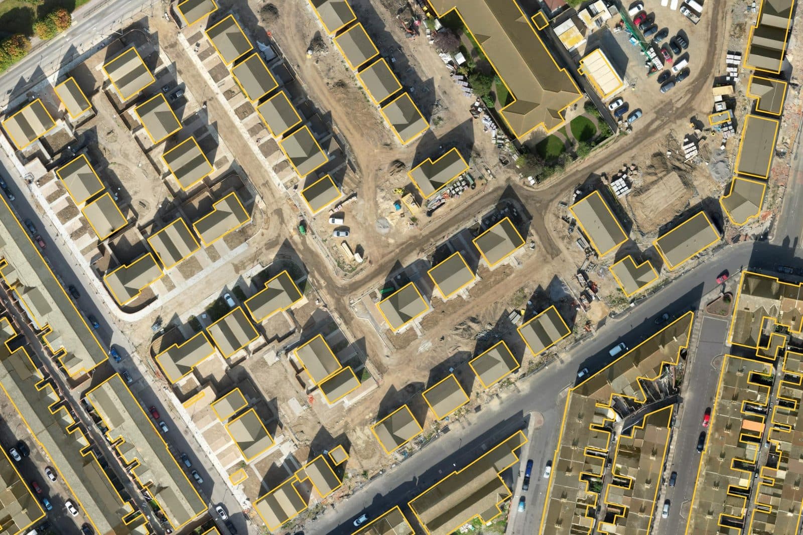
New-build housing. Semi-detached and detached homes on an estate under construction.
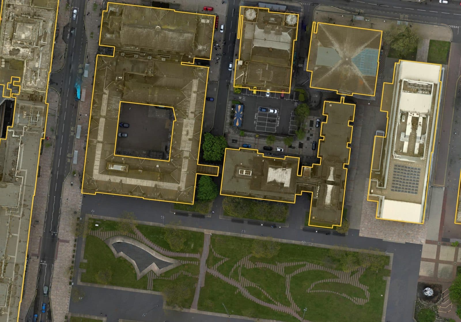
Town-centre blocks. Civic buildings and complex roof shapes around a town hall courtyard.
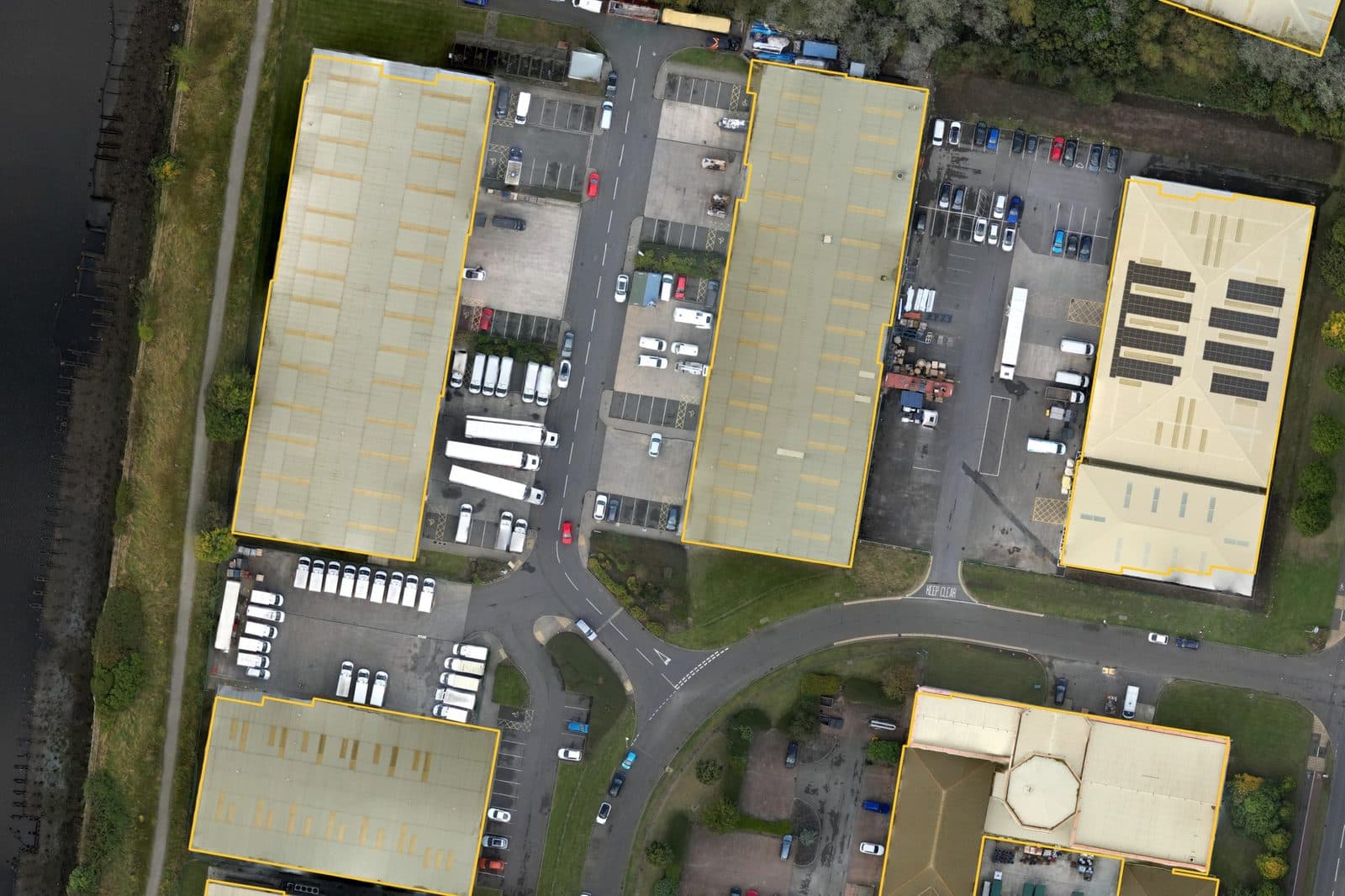
Industrial estates. Large warehouse roofs beside service yards, loading bays and the river.
92%
typical footprint agreement per address with outlines verified by people
94%
of roofs in our test areas are detected and given an outline
99%
of checked addresses point at the right building
98%
of buildings in Great Britain have lidar height
Built for your budget
National coverage, accessible pricing
A cost-effective alternative to traditional national polygon licences. Start with individual property queries, then scale to a portfolio extract or the full Great Britain dataset.
Pay per property
Get the main building and its outbuildings in one API response. Start with the properties you need, without purchasing national coverage upfront.
Scale with volume pricing
Buy an extract for your portfolio or request the full GB dataset. Volume and flat-rate pricing help you budget for larger projects.
Get more than polygons
UPRN links, roof area, height, volume and confidence come with the outlines, reducing the work of sourcing and joining separate datasets.
Same API, more answers
Combine it with the rest of the record
Free AVM
Get instant property valuations using our free Automated Valuation Model at no cost.
Address Autocomplete
Precise and reliable address autocomplete for the best property search experience.
Rebuild Costs
Obtain accurate rebuild cost estimates for every kind of residential property.
Cladding
Screen every UK block of flats for cladding presence, likely materials and indicative external-wall fire risk.
Global Perils
Retrieve worldwide flood, wildfire, earthquake and other natural hazard data for any coordinate.
Planning Permissions
Explore standardised UK planning applications, decisions, constraints and documents linked by UPRN.
Commercial properties
Leverage our extensive data on commercial properties, from warehouses to offices and retail.
AI
Access the largest property image dataset, with over 1bn property images for Generative AI training.
FAQ
Building Polygons: questions answered
What are building polygons?
Outlines of every roof in Great Britain, traced by an AI model from 25 cm aerial photography and lidar height, then cut to the land-registry parcel and linked to the addresses on it. You get the house and every garage, shed and extension, each with its area, height and confidence.
What does the API return?
On the Ultra tier, ultra.property.attributes.footprints returns the main building’s id, WKT outline, roof area, height, volume, confidence label, confidence score and matching method. It also returns the outbuilding count, total roof area, average height and a list of outbuilding footprints with measurements and confidence. Outlines use the British National Grid (EPSG:27700). The older Premium outbuilding fields are based on lidar alone. See API documentation
What counts as an outbuilding?
A roof at least half inside the property’s parcel that is not the main building of any address on it. Roofs that sit mostly on a neighbour’s land are left out, so no building is counted twice.
Why does a flat show no outbuildings?
Outbuildings are listed for the owner of the parcel: the house, or for a block of flats the parent building rather than each flat. That stops every flat in a block repeating, and pricing, the same garages.
How accurate is it?
On held-out test sites from Aberdeen to the south coast, outlined and checked by people and never used in training, the median footprint agreement per address is 92% and 94% of verified roofs are found. 99% of checked addresses point at the right building. Every roof carries a confidence score and tier, and areas without lidar are flagged rather than hidden.
What is the coverage?
England, Wales and Scotland. 98% of buildings have lidar height (England 99.6%, Wales 100%, Scotland 85.8%); the rest, mostly in the Highlands and islands, are drawn from photography alone and flagged. Northern Ireland is planned as a later release.
What makes Chimnie a cost-effective option for national building polygons?
You can start with individual property lookups instead of purchasing a complete national dataset upfront. Each response includes the main building and its outbuildings, with UPRN links, measurements and confidence. For larger projects, portfolio extracts and full GB coverage are available with volume and flat-rate pricing. Discuss polygon dataset pricing
Can I get the whole dataset?
Yes. The full release is GeoParquet on the British National Grid with one row per roof per property, joinable on the INSPIRE parcel id or through our UPRN links, plus a companion file for buildings on unregistered land so nothing is silently dropped. Request the dataset
Start with up to £16 of free balance
Sign up, grab an API key and query any of the 35M+ UK properties in minutes. No card, no contract.